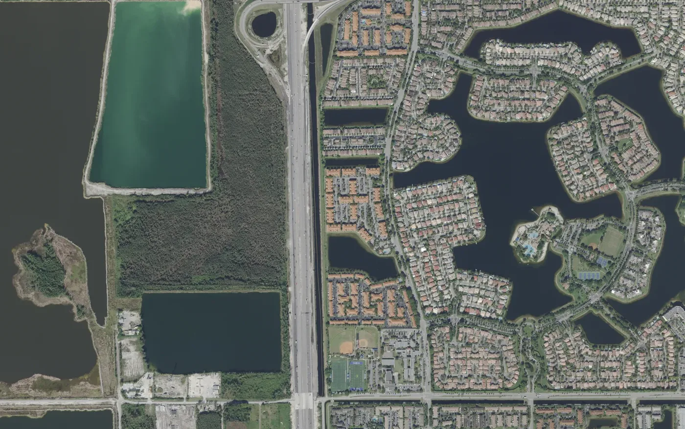
Doral Isles, west of NW 107th Avenue between NW 58th and NW 74th streets, has 2,942 homes, 90% zoned for Ronald W. Reagan/Doral Senior High.
Last checked Oct. 8, 2026. Sources: the City of Doral’s community map and parks pages, the Property Appraiser of Miami-Dade County’s parcel data, Miami-Dade County’s school attendance zone maps, the Florida Department of Education’s 2026 school grades, Zillow Research, Miami-Dade Transit and OpenStreetMap.
Doral Isles is the northwest part of Doral between NW 58th and NW 74th streets, from NW 107th Avenue to the city line at Florida’s Turnpike. Its sections, named for islands and seas, sit on peninsulas between man-made lakes, with a clubhouse in the middle. Nearly all of it was built between 1996 and 2009.
What this means for you
- Zoned high school: Ronald W. Reagan/Doral Senior High for 90% of homes, J.C. Bermudez Doral for the rest. Check your address in the district’s SchoolFinder.
- Home value: $553,694 in ZIP 33178 in August 2026, according to the Zillow Home Value Index.
- Nearest expressway: Florida’s Turnpike exit 31, NW 74th Street.
Part of our Doral neighborhoods guide.
Where it is
The county’s plat records name the sections here Doral Isles: Doral Isles Antigua, Antilles, Caribbean, Catalina, Cayman, Martinique, Mediterranea, Pacifica, Riviera, St. Croix, St. Lucia and Venetia, plus The Courts at Doral Isles and The Gates at Doral Isles. The city’s community map uses the same section names and adds Barbados, Palm Gardens, St. Tropaz and the Captiva condominiums along NW 107th Avenue. OpenStreetMap maps the Doral Isles Club House inside the area and Doral Isles Plaza, a shopping center, at NW 107th Avenue and NW 58th Street.
The Property Appraiser’s records list 2,942 homes: 49% condominium units, 47% single-family homes, nearly all cluster homes, and 4% townhouses. Of them, 65% were built in the 2000s and 34% in the late 1990s. All are in ZIP code 33178.
Schools
Shares are of the area’s home parcels in Miami-Dade County’s attendance zone map. Grades are the state’s 2026 school grades.
| Level | School | Share of homes | 2026 grade |
|---|---|---|---|
| Pre-K to 8 | Dr. Rolando Espinosa K-8 Center, 11250 NW 86th St. | 90% | A |
| Pre-K to 8 | Eugenia B. Thomas K-8 Center, 5950 NW 114th Ave. | 10% | A |
| Middle (zone map) | Ruben Dario Middle, 350 NW 97th Ave., Miami | 100% | A |
| High | Ronald W. Reagan/Doral Senior High, 8600 NW 107th Ave. | 90% | A |
| High | J.C. Bermudez Doral Senior High, 5005 NW 112th Ave. | 10% | A |
The split follows one community: The Gates at Doral Isles, off NW 60th Street near NW 114th Avenue, is in the Eugenia B. Thomas and J.C. Bermudez zones in the county’s map, and the rest of the area is zoned for Espinosa and Reagan/Doral. Eugenia B. Thomas K-8 Center is inside the area, and since March 11, 2026, the city has issued speeding citations from a school zone camera there. The county’s middle school map places all of Doral in Ruben Dario Middle’s zone; the K-8 centers teach through eighth grade. More in our schools guide.
Home values
The typical home value in ZIP 33178 was $553,694 in August 2026, down 1.07% from $559,660 in August 2025, according to the Zillow Home Value Index. The index is a modeled typical value for the middle third of homes, not a sale price. ZIP 33178 covers most of Doral; Zillow’s index for the whole city was $543,159, down 1.16% on the year. More in our home prices guide.
Parks and trails
From the city’s parks pages:
- Doral Meadow Park, 11555 NW 58th St.: 14 acres with two lighted soccer and football fields, two baseball fields, batting cages and a Vita Course fitness path, with a bikeway to Trails & Tails Park. The picnic area and playground are closed for improvements. Pets are not allowed. Phone: 305-593-6606.
More in our parks and trails guide.
Getting around
- Expressways: Florida’s Turnpike exit 31 is at NW 74th Street, at the area’s northwest corner, and exit 29 at NW 41st Street, by the exit numbers in OpenStreetMap.
- City Hall: about 3.8 miles from the middle of the area by road.
- Airport: about 10.9 miles to Miami International Airport. Both are distances measured on the OpenStreetMap road network with the OSRM routing engine, not drive times.
- Doral Trolley: Route 1 stops at Barbados, Doral Isles and along NW 114th Avenue, including Eugenia B. Thomas K-8 at Doral Meadow Park; Route 3 at Doral Isles, The Courts and E.B. Thomas; and the FIU route at Doral Isles Plaza on NW 107th Avenue, according to Miami-Dade Transit’s schedule data. See the city’s trolley page.
- Metrobus: no route stops inside the area.
More in our getting around guide.
Groceries and everyday stores
From OpenStreetMap:
- Publix, 10715 NW 58th St., in Doral Isles Plaza
- Sedano’s, NW 107th Avenue at NW 58th Street, across NW 58th Street
How we drew this area
The edges follow NW 58th Street, NW 74th Street, NW 107th Avenue and the city line, and are approximate. Home counts and school zones come from every home parcel inside them in the Property Appraiser’s records and the county’s attendance zone layers, checked Oct. 8, 2026. Store locations are © OpenStreetMap contributors.
Frequently asked questions
Is Doral Isles a good place to live?
Here are the facts. Doral Isles is the lake-ringed area west of NW 107th Avenue between NW 58th and NW 74th streets, with 2,942 homes built from 1996 to 2016 and Doral Meadow Park. Most of it is zoned for Dr. Rolando Espinosa K-8 Center and Ronald W. Reagan/Doral Senior High, both graded A for 2026, and Zillow put the typical value in ZIP 33178 at $553,694 in August 2026.
What high school is Doral Isles zoned for?
Ronald W. Reagan/Doral Senior High for 90% of the area’s homes and J.C. Bermudez Doral Senior High for 10%, in Miami-Dade County’s attendance zone map. Check one address in the district’s SchoolFinder.
What are the sections of Doral Isles?
The county’s plat records name sections including Antigua, Antilles, Caribbean, Catalina, Cayman, Martinique, Mediterranea, Pacifica, Riviera, St. Croix, St. Lucia, Venetia, The Courts and The Gates.
What ZIP code is Doral Isles?
33178, for every home in the area in the county’s parcel records.
Have your say